


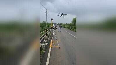
Surat: The Surat Municipal Corporation (SMC) on Wednesday launched a hydrology survey to tackle flooding caused by overflowing creeks, with plans to develop a detailed 3D model to guide future flood mitigation measures.As part of the first phase of the LiDAR-based study, drone-mounted cameras are being used to capture high-resolution images of creek corridors. Officials said the survey will map the course and flow of creeks and identify locations where water movement is obstructed.The exercise will record key physical parameters such as the length, width and depth of the creeks, while also documenting encroachments, silted stretches, solid waste accumulation and other obstacles that reduce carrying capacity and trigger flooding during heavy rainfall. Several sections of the creek network remain choked with polluted water and waste, making them more prone to overflow.Based on the findings, the civic body will prepare a mathematical model to simulate flood scenarios and support planning for mitigation measures. The model is expected to help SMC prioritise interventions such as desilting, cleaning and infrastructure improvements.“The survey and study are expected to be completed within three months. Once the findings are compiled, SMC will prepare an action plan and undertake the required infrastructure works,” a drainage department official said.Following creek-related flooding in 2024, SMC had proposed a similar study through the Japan International Cooperation Agency (JICA). Although a JICA team presented the proposal to the then municipal commissioner, the project did not move forward.


